Monday, February 13, 2012

"Crossed the deserts bare, man, I've breathed the mountain air, man" - Utah traverse!

Hi all,

Our revised itinerary took us from northernmost Utah almost due south to Arizona. The state of Utah is beautiful and so diverse in terms of the geology/geography. The Johnny Cash line in the title is a little misleading, as we encountered the mountains FIRST as we were driving south and ended in the desert.

Our first stop of interest the morning of our Utah traverse was the Great Salt Lake. Below is a satellite image of the lake, it's huge! The size makes it almost impossible to get a good view of it from the ground. The lake is the largest U.S. lake west of the Mississippi River. It is a remnant of Pleistocene-age Lake Bonneville, which was about ten times larger than the current size of the Great Salt Lake. At ~75 miles long and 25 miles wide, it's the 4th largest lake without an outlet in the world! It is only about 35 feet deep though, making it comparable in depth to the Chesapeake Bay. It is about 3-5 times saltier than the ocean and has no fish. Source: USGS Water Science Center.


One of the places recommended for viewing the lake was Ensign Park, a park in Salt Lake City, that is perched on top of a hill, ideally to get better viewing. What the website didn't say was that this park is a site of historical/religious significance for Mormons, so we were in the religious minority at the top. Oh, and did I mention this was the day of the rapture? So everyone else there had hymnals and were singing and praying and having picnics. We were just trying to get a view of the lake! This is me at the top of Ensign Peak with the lake in the background. Note how the water embays the ridges - the large Pleistocene lakes that formed in this area formed by rainfall filling up the low-lying areas (basins) between the high ridges (ranges) of the Basin and Range province that extends through most of the southwest and into Mexico. More on Basin and Range paleolakes in the posts about my trip to the Quinn River!


Salt Lake City seems like a nice place - it looked clean and not too built up. I've been told it's one of the prettiest airports in the U.S. to fly into, which I would believe considering the lake and snow-capped peaks all around! The picture below is from Ensign Peak, looking down on the Utah state capitol building.


After leaving Salt Lake City, we traveled a short distance south to visit the Bingham Canyon Copper Mine, the largest open-pit mine in the world! This is a picture taken from the interstate - the brown mounds are the sides of the mine - look how tall it is compared to the mountains!


This is a view down into the mine from the visitors' parking lot:


The visitors' center was really informative - there was a lot of historical stuff about the mine, a good display on how copper goes from copper ore to thick sheets of pure copper (the stuff that gets sold!), copper-bearing mineral samples, and displays of everyday, household objects that contain copper. There were also some pretty pieces of art made from copper and other metals. Megan and I both took a picture of this piece, so it must have been pretty good!


From the mine, we drove south toward Moab, and Arches National Park. As we drove, we saw some exposures of the Book Cliffs. These rocks are so named because they look like the side view of a book that has been opened and laid down on its cover. The layers of sedimentary rock include sandstones, shales, and coal beds, and represent the sediments of the Great Cretaceous Seaway that filled the interior of North America. The Cliffs are where Exxon geologists developed the practice of sequence stratigraphy in the 1980's. This is a picture we took from the road:


It's easy to see why people name rocks things like "ship rock" out west. I had never seen landscapes like this in person until this trip. The land is so flat, and some of the rocks are so isolated and stick up so abruptly from the surroundings, that they really do look like ships on a dry sea.


We arrived at Arches National Park around dinner time, only to find that all the campgrounds were full. We spent the majority of the evening and night driving around looking for a place to camp. Every single campground was filled up. We ended up unofficially sharing a family's campsite around midnight. We only infringed for about 5 hours before taking option c - sneaking out in the middle of the night! Just like at the Happiness Hotel (reference: Great Muppet Caper)!!!! That was probably our roughest night - most people didn't even pitch tents, they just slept in their sleeping bags on a tarp on the ground.

My real work is calling...unfortunately. Next post: Arches and Canyonlands!

Happy trails!
Sarah

Wednesday, February 8, 2012

Southbound

Hi all,

So we left off in northeast Wyoming at Devil's Tower, having made the decision to go south. We got a late start the next morning, as we were no longer on a set itinerary. The majority of the day we spent driving through Wyoming. We basically cut straight across from the northeast corner to the southwest corner. Below is the revised map of our trip:


Wyoming is an interesting state. It is divided up into isolated mountain ranges with large basins between them. What was surprising to me though was although it's not a desert, how brown and dry it looked in most places. There are a lot of natural resources though - there are lots of mining operations in Wyoming and you can see a lot of open pit mines and rigs from the interstate. Wyoming produces the majority of the coal in the US, which surprised me. We pulled over on the side of the road to check out this coal mine:


When coal seams catch on fire naturally - usually by lightening strike - the seam is burned to a red color and forms a resistant unit. This is referred to as "clinker." Because it is more resistant to weathering than the surrounding sedimentary rock, it forms the caps of mounds of rock. Wild coal fires in the Powder River basin of Wyoming were reported by Lewis and Clark during their expedition west.

It took most of the day to drive across the state. We ended the day at Fossil Butte National Monument, which was one of our stops in our original itinerary for the drive home. Fossil Butte is in the southwest corner of Wyoming, close to the borders of Utah and Idaho. We got to the visitors' center just a few minutes after it closed. The park ranger was heading to his car as we pulled up and upon seeing our vans, asked if we were from UT. When we said yes, we were from UT's geology department, he told us that he had been a master's student in our department years ago and reopened the visitors' center for us! Fossil Butte is known for the amazing fish fossils that come from there, but as I saw in the visitors' center, ALL the fossils - plants, fish, other animals - are equally amazing and beautiful!!! This site was a lake that had hosted many species of land and aquatic organisms. For some reason, which I believe is still unknown, the fish all died very suddenly, resulting in huge numbers of fossils in each layer of rock. Lakes are good places to preserve fossils are they are low energy environments and the rocks that form in them are fine-grained, so it is easy to see the fossils. Visitors to Fossil Butte can pay $40 to go out to the rock units and take home as many fossils as they want. Unfortunately, because we got there so late, we were not able to do so, but we did do a short hike up to the quarry where the scientists collect fossils. Here are some of my favorite fossils from the visitors' center:


This is me in front of the quarry rock layers. Note how thin and perfectly flat the layers are! This is characteristic of lake deposits. Also note how many layers I'm wearing! Dinner time in the Rockies is pretty cold!


We camped that night at Bear Lake, Utah. This was the view from our campground the following morning: so pretty! And look at the snow!


We hit the road in the morning after some tasty pancakes made by Cassaundra and Caycee:


A few miles down a pretty, windy, mountain road from our campground, we stopped to get a look at Bear Lake. Megan, me, and Felicia in the parking lot in front of the lake:


Northern Utah in a word was BREATHTAKING. The Rockies are "rockier" here than in the parts of Wyoming we saw and are all topped with snow. We drove by the Utah State campus and I almost got out of the car and transferred on the spot!! It's in such a beautiful location. I think most of our students were the most excited for southern Utah, which was also very cool, but northern Utah was amazing.

Got to go prep for my second lab section of the day! Next up: Utah traverse!

Happy trails,
Sarah

Thursday, January 26, 2012

Over the ground lies a mantle of white...

Hi all!

So on day 3 after visiting Crazy Horse, we headed to our campground and made dinner and set up our tents. It was raining on and off and pretty cold, but we had some tasty chili and Jackson somehow managed to build a fire, despite the wet conditions. The next morning it was pretty cold when I woke up, as I was getting out of the shower, Felicia was entering the bath house, shivering, and complaining about walking from her tent in the snow. Assuming she was over-exaggerating, I laughed, until I stepped out the door and saw this:


That white stuff on the ground and on our tents? Snow. And it only got worse as the day progressed!! Nevertheless, after packing our stuff up, we headed to Mount Rushmore to try to catch a glimpse of the presidents' faces, despite the fog, snow, and cold. We took the Needles scenic by-way that goes through the Black Hills area, and it was beautiful! A few things about the Black Hills: the Black Hills were formed during the uplift of the Rocky Mountains - they are actually billion-year-old metamorphic rocks that have been brought to the surface and broken through the overlying, younger, sedimentary rock units. The main granite in the Black Hills is the Harney Peak granite, which is what Mount Rushmore and Crazy Horse are carved in. The granite is very old, about 1.7 billion years old, but is younger than the metamorphic rocks of the Black Hills that it intrudes. The granite was brought to the surface as the Black Hills were being formed, about 50 million years ago. The "Needles" that are referred to in the area are the granite peaks that are resistant to weathering and stick up like needles from the rest of the landscape. Interestingly, the Turks give granite peaks the same name! "Sivri" means "needles" in Turkish and the town of "Sivrihisar" was named for the surrounding granite peaks in the mountains. The granite, at least from a distance, is very white, which seems to be in conflict with the "Black Hills." The Black Hills got their name from the dark dark green pine trees that are so abundant in the area and make the hills appear almost black from a distance. Unfortunately, the pine population in the area is suffering due to the recent arrival of a pine beetle of some sort. The trees that are still there though looked beautiful in the snow! This is a picture of what the Needles by-way looked like as we were driving back from Mount Rushmore. The "blackness" of the hills is very apparent here against the white snow!


Here is a picture of Mount Rushmore taken from just outside the Visitors' Center door. I think I was one of the few people to get a shot of it! The fog was very thick and after hanging out by the door for a while, I managed to snap this during a tiny break in the fog. Good things come to those who wait :)


After braving the cold and snow to get a glimpse of Mount Rushmore, we took in some local culture at the "Sugar Shack" - home of the best burgers in the Black Hills! Megan and I were sitting at the counter though where we had a good view of the food prep station - the burgers were frozen. Oh well! Everyone enjoyed their lunch and the toasty diner nonetheless! They had a really high-tech fire alarm there, I felt like I had to get a picture. Maybe these devices will eventually make it to the rest of the country:


Thanks for the tasty grilled cheese, Bubba! I'll definitely be back :)

While the lunch at the Sugar Shack was good, this was also the place where mutiny and dissent began to grow. The majority of the trip participants, despite our warnings about average temperatures and weather conditions in the areas we would be traveling to, did not bring cold weather clothes or snow gear. In addition, we learned from the park rangers at Mount Rushmore that a huge snow storm was sitting over Yellowstone and was effectively not moving. Many of the roads into Yellowstone were closed due to the storm. Thus the idea of going south was born. However, we continued on our intended path that afternoon - ending the day at Devil's Tower National Monument in Wyoming.

There are several theories for how Devil's Tower was formed, however, all geologists recognize that it is an igneous intrusion of some variety that has undergone some degree of erosion, creating the tower shape seen today. It is made of a rock called "phonolite" which gets its name from the ringing sound the rock makes when struck with a metal object. It was not snowing at Devil's Tower, so we were able to do the ~1 mile hike around the base of the tower. This is me at the start of the trail.


You can see that the tower looks like a handful of pencils or rods of some sort. These are called columns. When magma cools underground, but in the shallow subsurface, it forms columns. These formations are often called "columnar basalts" and can be found around the world. A well known example is the Giant's Causeway in Ireland. The columns break over time due to physical weathering processes, littering the ground around the base with broken pieces of columns of various sizes and leaving the remnants stuck onto the tower.

From Devil's Tower we found our campsite but due to the inclement weather the night before, we opted to rent a few cabins the campground offered over using our tents. That night Megan and Kevin and I looked up weather reports and maps and made the decision to abandon the northern route and adopt a southern route instead. Our mutinous crew was very excited by the change of events and many students partook in revelry that lasted very late into the night.

Seminar time! More later on how our adventure progressed into uncharted territory!

Happy trails!
Sarah

Wednesday, January 25, 2012

Geoclub trip - The Geology of South Dakota, abridged.

Hi all!

Today I'm going to write about the geology we saw in our few days in South Dakota. As I think I said in one of my last two posts, there's so much to see in this area, it was impossible for us to see all the great stuff that's there, or even see everything at the places we did stop. This was a constant frustration for students throughout the trip who wanted to see everything at every stop. I tried to see it as a whirlwind tour, so that I would know where I wanted to return to in the future and how much time I would need to do it justice!

On day 2 of the trip we arrived at Badlands National Park in the mid-afternoon. The Badlands were so named because when French fur traders were traversing the northern part of the US, the rugged topography and barren landscape were "bad lands to cross." We now refer to "badlands" in the general sense as any sort of rugged landforms featuring sharp ridges. Typically, badlands are formed in relatively soft,sedimentary rocks (ex. mudstones) due to erosion by rainfall and runoff. The picture below is characteristic of the South Dakota Badlands. Today with park roads winding through it, it is not difficult to cross, but you can imagine that the first settlers to cross through this territory may have found it intimidating!


The Badlands are composed of many many layers of soft sedimentary rock, but the layers can be grouped into three sections based on rock type and erosional characteristics. In geology the technical term for this is "lumping." Students are often encouraged to "be a lumper not a splitter!" because it makes large-scale geologic interpretation more manageable. So if we "lump" the rocks, we see three groups with easily distinguishable characteristics. The lowest "lump" is composed of weathered shale, a fine-grained, mud-rich, rock. The shale weathers to a variety of colors, including gray, white, red, and yellow. Because shale is so soft, when it erodes, it forms rounded mounds. This is me giving some sort of lesson about horizontal layering of sediments, with the brightly-colored shale mounds in the background.


The clay in the shale forms a cool texture on the surface when it absorbs water and expands then contracts. The texture is called "popcorn texture." Yet another highly technical geology term :) Here is a close-up of the clay "popcorn" in the lowest lump.


The middle lump is also composed of a lot of mud and clay, but rather than being weathered shale, these are sediments that were carried east from the rising Rocky Mountains several tens of millions of years ago. The middle lump features thin, almost perfectly horizontal layers, in pastel colors. The rocks do not form mounds as they erode, but the rainfall does create sharp gullies that carve the slopes of the rocks and cuts across the layers. Some layers are more resistant than others due to a larger grain size or natural cements. These layers stand out against the more mud- and clay-rich layers. The middle lump is the thickest section of the Badlands and is what you see in most pictures:


Note how sharp and narrow the ridges are! Alan Howard says "you can't drink too many beers and walk on those things!" So true. The uppermost lump is fairly unique in the set. It is the thinnest lump by far and is composed of some layers of the mudstone, but has several layers of volcanic ash as well. The ash layers are bright white and more resistant to weathering than the mud, making the uppermost lump the most rugged. The bright white horizontal layers near the tops of the rocks in this picture are the ash layers. The ash was carried by wind from the volcanoes on the west coast of the U.S.


The Badlands have preserved a great collection of fossils from roughly the Eocene epoch, about 50 millions year ago. These fossils are about the same age as the fossils at the Gray Fossil Site near Gray, Tennessee. Similar animals are found at both locations, primarily mammals. The prehistoric creature that Nicole found most interesting at the Badlands Visitors' Center was the "pig dog." Pig dog is an actual animal from that time period, and fairly ferocious, at least based on the appearance of the fossilized form!

We camped in the Badlands that night - this was our campsite, how beautiful!!!!


The next day (only day 3!) we woke up early and drove further west to the Rapid City/Black Hills area of South Dakota. Kevin made us AWESOME burritos for breakfast on the campstove with eggs, cheese, onions, green peppers, and salsa. Yum!!

Our first stop of the day was at the SDSM&T geology museum on campus. Having been a SDSM&T student for a few weeks the summer before, I was excited to see the campus for the first time! It's very small, but their geology museum is really great! It takes up the whole floor of a pretty large building and has tons of fossils and great mineral, rock, and meteorite samples. I wish we could have a collection even half as big at McClung!! We spent about 1.5 hours looking around. We had some very intellectually inclined students on this trip, they made us so proud everywhere we went! :)


From the SDSM&T geology museum we headed over to the town of Hot Springs to the Mammoth Site. The Mammoth Site has the best collection of preserved mammoths anywhere in the world! The museum there is really cool, as it is also an active dig site that is staffed by seasons of volunteers. Anyone can volunteer to participate in the dig, you just need to go to an orientation! The museum was built on top of/around the dig site, so the dig is completely enclosed in a building that houses paleontology labs and the museum. The reason there are so many mammoth fossils here is because there used to be a watering hole at the location of the dig site during the Pleistocene epoch. However, the sides of the watering hole were steep, and the rock was shale (lots of mud, remember!), so the banks of the watering hole were steep and slick. Animals would try to get down to the water's edge but would not be able to climb back out, so they would drown. Over time, the lake filled in with mud and other sediments, forming a giant mammoth tomb. This is the location of the current museum. Below is a picture of a volunteer doing some excavation around a mammoth skull.


The last stop of day 3 was at Crazy Horse National Monument. It was too foggy to see the actual carving of his face, which was too bad, but we did watch the video of how the carving was started, and where they are now in terms of progress. Answer: not very far. When the sculpture is finished it will be the largest stone carving in the world, however, only a very small amount has been completed, as it is funded entirely by donations. There are two nice museums there, however, one with lots of Native American history and one about the designing and beginnings of carving the monument. Crazy Horse is carved from the same stone as Mount Rushmore: the Harney Peak granite. They save the smaller pieces when they blast and give them away to visitors. I'm not sure how many visitors want to take home a chunk of granite, but all of us swarmed the big crate of rocks and were very competitive about what pieces we dug out! It was pretty cold that evening and starting to drizzle, so the free coffee was also definitely welcome! The weather that evening should have tipped us off...continue to the next post (once I write it) to see why!

Got to go do a lab report!

Happy trails!
Sarah

Saturday, January 21, 2012

Geoclub trip Day 2 - A trip to Jurassic Park

Hi all!

Sorry for the false advertisement in my last post that I would have the Day 2 post finished last night - I had more schoolwork than I originally envisioned.

Anyway! So Geoclub trip day 2 - I left off in my narrative with Felicia's underwear being found in the road as we left our campsite that morning. After a quick breakfast at Mickey D's we hit the road and headed for our first stops of geologic interest in South Dakota. Again, let me start out this blog post with a huge endorsement - I went to field camp in Turkey (see previous posts) but the program was through South Dakota School of Mines & Technology. SDSM&T, located in Rapid City, SD, also runs a field program in the Black Hills. When I was applying to the Turkey program, I remember seeing the Black Hills option on the website as well and thinking "who would want to do that? lame." Judgmental, yes. BUT what I can now honestly say, as a previous skeptic, is that the Black Hills area of South Dakota is AMAZING!!!!!! The Hills themselves are pretty small but the area is beautiful and there's so much interesting stuff there in terms of geology, history, and cheesy tourist stuff (more on that later!) that Megan and I both felt like we could have spent several more days there.

Our first stop in South Dakota was in the town of Chamberlain, which is located on the Missouri River ("Big Muddy!"). We stopped there for a picnic lunch and showed the students the river terraces along the present channel. River terraces are abandoned floodplains that were active when the river was higher than its present level. That doesn't mean the river was actually deeper and filled the channel up to the height of the terraces, it means that the river hadn't cut through the material beneath yet. As the river erodes and cuts down more and more, it creates a deeper and deeper valley with several generations of terraces. A lot of field camps that go west stop at this location to see the terraces, so maybe our students will be seeing this spot again! Here is a picture of Kevin teaching the group about terrace formation and the type of rock seen in the background:


Megan and I spent a lot of time in the car reading aloud to each other from the "Roadside Geology" series. There is a book for every state (I think?!) and we had them for all the states we visited!! We got pretty into even the details of what we were seeing on the trip. For instance, we were nerdily able to immediately identify the rock type of the rip-rap along the river bank as being Sioux quartzite! It is a metamorphosed sandstone stained by oxidized iron-rich grains in the sand, so it has an overall pink appearance. Me being a nerd with my book (note the quartzite!):


I noticed that South Dakotans are pretty into three things: 1) dinosaurs, 2) large fake rodents, 3) advertising. One of the South Dakota gas companies has green dinosaurs at all its stations, so we saw lots of those guys, but we also saw lots of dinosaurs just hanging out in fields on the side of the road. Felicia and me on the gas station dinosaur:


Random local dinosaur grazing in the field along the interstate:


South Dakotans also like really large chipmunks apparently. This is the world's largest chipmunk, weighing 6 tons!


South Dakotans also really like advertising. For just about anything. You wouldn't believe how many signs there were for that chipmunk alone! There are many, but probably the biggest tourist trap in South Dakota is Wall Drug. What started out as a tiny drug store in Wall, SD, in the 1930's has grown into a sprawling tourist trap, complete with, as one might expect, a large dinosaur. It's basically the South-of-the-Border of the North. We saw signs for Wall Drug starting about 2 hours away from it. I think I counted about 90 signs total... We ate dinner at the Mexican restaurant there on night 2. This is the big sign out front when you pull up:


When in South Dakota though, make sure not to miss other great tourist attractions like 1880 Town (also has a dinosaur close by), the Corn Palace, and Deadwood!

I think I'm running out of usable space in this post (too many dinos and big chipmunk pictures!) so I'll have to make the next post about the geology of what we saw in the Rapid City area. We spent several days in the area, so consider this post all the "cultural" stuff from South Dakota and the next will be about the actual geology.

As some of you might know, at the time of writing, I am on a 13 days on $13 regimen. I am finding that when you can't spend money, you have much more time to do things you otherwise wouldn't do like read books and blog :) It's kind of nice! So be expecting regular postings over the next week+.

Happy trails!
Sarah

Friday, January 20, 2012

Geoclub trip...finally! - In the beginning there was a van...

Hi all!

So I'm finally starting to write about the Geoclub trip I took in May. I think it took this long just to process all the cool things I saw on the trip!

One of my favorite books, The Phantom Tollbooth, has a review on the back cover that starts with "Let me start by saying, this is the best book ever." Since the first time I read that book I have been impressed that someone publicly gave a book such an outstanding endorsement. The best book ever?!?! Wow! Well let me start my recollections of this trip by saying, after months of ruminating on the events of those two weeks, that this was the best trip ever. Hats off to Megan for her wonderful planning and improvising along the way!

Our first day we left the geology building at 6 am with our destination for the day being Lewis and Clark State Park, Iowa. We had several misadventures that day, beginning a mere three hours later at 9 am when we stopped in Kentucky for gas and gas station fare for those who hadn't brought breakfast. Everyone spills out of the big van, with Megan and myself being the last ones out. My "job" is to run over to the gas station to see if they take our Fleet 1 card that we had to use for the university vans. Upon returning, Megan whispers to me, "Sarah, I think I locked the keys in the van." Her suspicions were confirmed immediately by peering in through the van window. Yep, right there in the cupholder, the only set of van keys. As everyone hunkered down in the town's Chamber of Commerce building to stay out of the windy, unseasonably cold weather, we managed to call a local locksmith who was able to retrieve the keys for us. So with a slight delay, back on the road again!

This was taken when passing through Nashville, Illinois, if I remember right. It wasn't Nashville, TN, which was why we took the picture.


Strangely enough, we had a huge number of St. Louis fans in the car. Not sure what the hype is all about, but we did take this picture while driving by on the interstate.


There's not much geology above the ground driving through the Midwest. A lot of the geology of Indiana and surrounding locations is below the ground as caves. So not too much to see the first day aside from water towers and arches. However, we did encounter some "excitement" in Cameron, Missouri. In an attempt to catch up with the minivan, which had gained a considerable lead after our key excitement in Kentucky, we got a speeding ticket. However, not only did we get a speeding ticket, but all of us were asked to get out of the van and line up along the side of the road while the vehicle was drug-searched. All the dog found was my cinnamon-brown sugar mini-bagels. The process was long and drawn out, but at the end of the day we did find out, thanks to Megan, that the little camera in the cop car is not what they use to film "Cops." We were also informed by the cops that there are ticks in Missouri. Who knew?

The one piece of geology we did see that day were large loess deposits. Loess is very fine-grained sediment carried by wind that often forms steeply dipping mounds in previously glaciated terrain, hence the large loess mounds in the Midwest. Pictured below are the mounds we were able to see from the road.


We skirted Kansas City, so I didn't see it with my own eyes, but I'm sure it's plenty up-to-date! I have it on good authority from the minivan, which after the speeding ticket/drug bust had even MORE of a lead, that Omaha is pretty nice as well. Yet another place I didn't see with my own eyes.

We arrived at the state park very late that night and went straight to bed so we could get a fresh start in the morning. The morning started out quite exciting - as we were pulling out from our campsite someone spotted something magenta on the ground in the path of the van - it was Felicia's underwear. Great start to the trip: locking the keys in the car, speeding ticket, drug search, underwear in the road. Like I said, this was the best trip ever.

Got to go do real work, but I'll post Day 2 later tonight!

Happy trails!
Sarah

Friday, May 13, 2011

Trip West!

Hello all blog followers!

Monday morning at 6 AM I, along with 12 other UT geology students of varying age and grade level, are embarking on a 2-week road trip out west. We will be hitting the big national parks, monuments, and forests on the way: Badlands, Black Hills, Mt. Rushmore, Crazy Horse National Memorial, Tetons, Devil's Tower, Yellowstone, Bighorn Mtns, Glacier, Craters of the Moon, and the Green River Fossil site. And plenty of roadside geology in between! Below is a screen shot of Google maps showing our basic route.


I'll be off the grid while on the road, but I will take pictures and journal so there will be some nice blog posts when I get back!

Happy Trails!
Sarah

Tuesday, December 14, 2010

Meteor Crater adventures

Hola (I was kind of close to Mexico)!

So going back to some geology: in October I had the opportunity to attend the Meteor Crater Field Training and Research Program led by Lunar and Planetary Institute scientist Dr. David Kring. It was a program aimed at planetary geology graduate students. Our group of 24 consisted of students from lots of different universities, and different countries. Two guys hailed from Germany, two students from Austria, one from England, and one from Canada. Of the 18 students from the US, the universities represented were pretty prestigious: MIT, Harvard, Washington U. in St. Louis, University of Arizona, Arizona State, Purdue, Case Western, University of Texas - Austin, University of Colorado - Boulder, and, of course, University of Tennessee! There were two of us from UT, and I felt like that made our department and university look really good to be rubbing shoulders with the Ivy leaguers :) Most of the students (ok, all but me and Matt) were studying some aspect of impact crater formation, either on Earth or other bodies. I was mainly there to skip school (with a good excuse), find a real meteorite, and to get the behind-the-scenes tour of the crater with an expert. I definitely learned a lot about impact cratering - like how much I still don't know! I also learned about how COLD and WINDY Arizona can be in October!!

For starters, here's a picture of me on the crater rim:


Something that I had known before going and had even taught in Geology 104 lab (introduction to the planets) was that a defining feature of a crater is its uplifted rim. However, I hadn't given the word "uplifted" much thought until going there. Northern Arizona is pretty flat, and when you're driving up to the crater, it's definitely noticeably higher than the surrounding area!

The crater is actually "small" by impact crater standards; it's less than a mile across. It's also really young geologically - only about 50,000 years old!! For comparison, the Chesapeake Bay impact structure is 35 million years old and much much larger. Meteor Crater, however, is much better preserved than pretty much any other crater on Earth, making it ideal for study. It was first "discovered" in the late 19th century and was purchased by a fellow named Barringer. Barringer was into mineral exploration/resources and was primarily a businessman, having only an undergraduate degree in geology. He was essentially the first person to call the site a meteorite crater (others, including the head of the US Geologic Survey at the time, thought it was a volcanic feature) so he suspected that the meteorite that produced it may lie at least in pieces in the crater walls or under the crater floor. Basically, he thought he was going to make tons of money from unearthing an enormous iron meteorite. The crater became his obsession for basically the rest of his life. He made amazingly detailed and astute observations. In fact, many of his hypotheses still hold up even now with all kinds of new ways to collect information from the site. Just goes to show that you can learn a lot just by hanging out somewhere and walking around!

There were, however, some key aspects of crater formation that he didn't grasp. He thought the entire meteorite would be buried, intact, underneath the crater floor. He also thought the meteorite would be roughly the size of the hole. Wrong. Meteors that form craters are only a fraction of the size of the craters they form. The crater is formed from pressure and shock waves resulting from the fast-moving meteor crashing into the surface. Usually, the meteorite is either vaporized (if it's small) or broken into many tiny pieces and scattered. So while lots of meteorite fragments have been recovered from the site over the past 100 or so years, no enormous iron blob has been unearthed! But other than that, he pretty much got the story right. Yay for amateur scientists being awesome! Also, the Barringer family still owns the crater. It's actually not a national park/site, which is pretty amazing.

Some things about Meteor Crater that make it unique:
1) It's roughly square-shaped with rounded corners. Most craters on any planet are circular. This is due to the pre-existing perpendicular joints in the rock. When the impact occured, those weaknesses already existed in the rock, so the walls formed along relatively straight lines.
2) After impact, a lake formed in it. This is thought to be not uncommon in very ancient (4.5 - 3.75 billion year old) Martian craters.
3) A few areas around the rim are higher due to huge chunks of rock being shoved into the crater walls as they were forming. Weird.
4) Astronauts train there!
5) All the rubble/old mining equipment has been left the way it was after mining efforts ceased, so it's completely historically accurate.
6) It was a filming location for the 1980's movie, Starman. We watched it one night... I would not necessarily recommend.

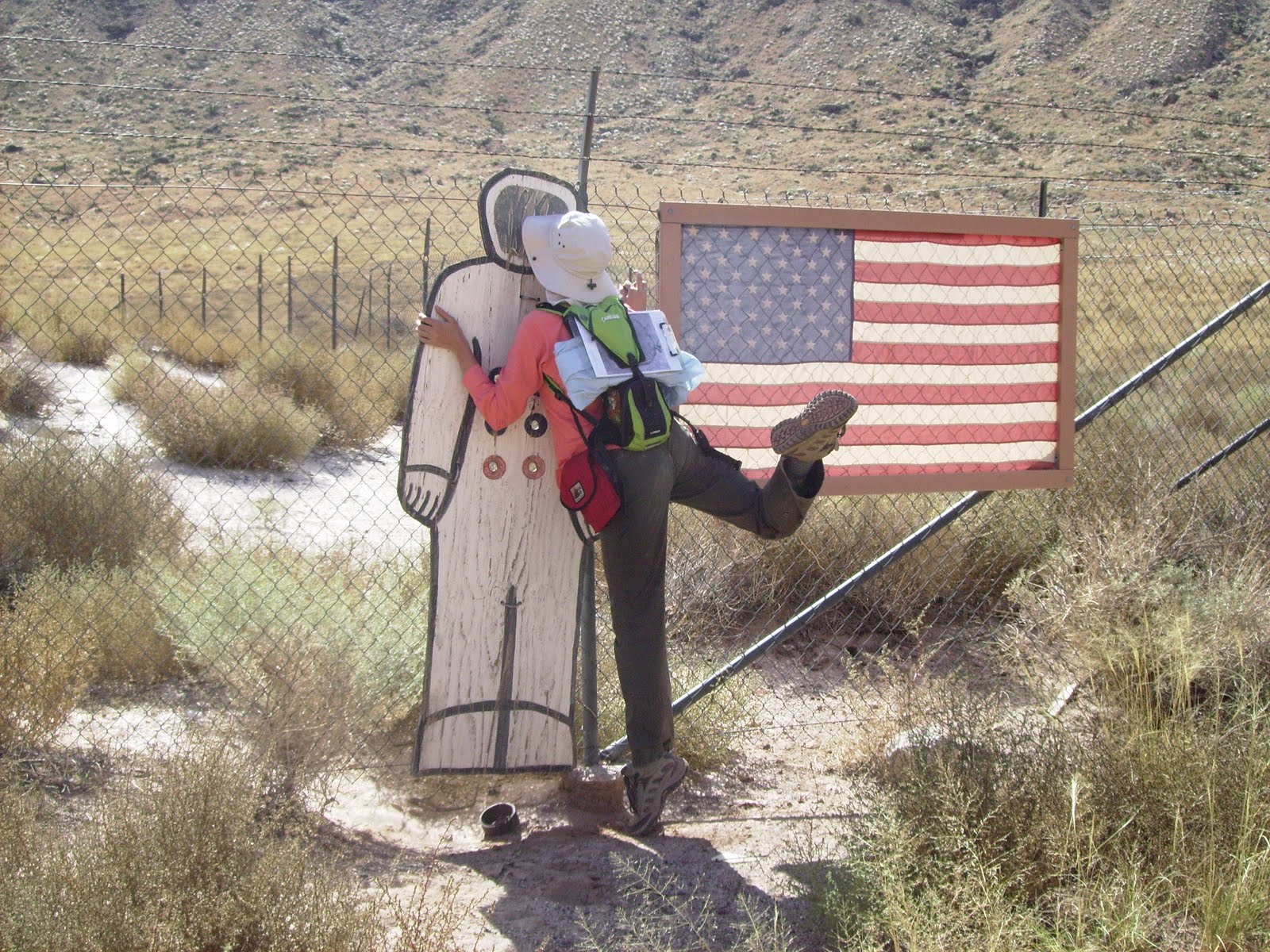
Apollo-era astronauts did a lot of training at Meteor Crater. On the crater floor (off-limits to tourists, but we got to go down), there is an American flag set up with a wooden astronaut cut-out next to it. Here's a picture of me and the astronaut:


Apparently rovers are trained there, too! Here's a Canadian Space Agency group testing a rover:


We spent the first two days basically hiking around and through the crater, which was pretty cool. Dr. Kring told us that taking samples from the crater was prohibited for tourists. Scientists were permitted to take samples that had already fallen to the crater floor to use for research, but each piece must be documented and registered. Any meteorite chunks that are found have to be left alone if they're still in the crater wall. They can be collected by meteorite scientists after they've weathered out, but Dr. Kring said that usually they would get lost in the material that had been rained down the slopes during the rainy season. He did show us a nice sample still stuck in the wall. We weren't even allowed to sit less than 5 feet away from it! Here he is pointing it out to us (it's the dark blob in the pinkish rock to his left):


Even though we weren't allowed to collect our own meteorites, we still ended up with samples anyway! A professor from Arizona State drove up and talked to us about meteorites and gave us goody bags with teeny meteorites from Meteor Crater in them!

We camped in tents at the Meteor Crater RV Park. Our fellow RV park residents were pretty colorful characters. We were the only group in tents, with the exception of a group of three hunters. They were pretty old and woke up at 4 AM every morning. Good campfire entertainment. Here's a picture of our tents lit up at night:


Our main project while there was to contribute to a research project Dr. Kring was heading up. We did all the data collection for the project and took lots of good pictures for the paper that will result. Admittedly, I didn't understand a ton of what we "discovered" but I did contribute by making very detailed rock descriptions!

At the end of the day, I learned a lot. I networked with my planetary peers, which is never a bad thing. I also learned though, that if you're going to Arizona in October, bring LOTS OF WARM CLOTHES and an alpine-grade sleeping bag. Consider yourselves warned! Sadly, we missed the Grand Canyon (not enough time!) but the trip definitely whet my appetite to explore the southwest!

Vaya con Dios!
Sarah

Monday, December 13, 2010

Istanbul, not Constantinople

Merhaba!

Sorry to leave you all in suspense! I did leave Turkey and have been back in the US since my trip over the summer :) This will be my last post about Turkey (unless the photo sizes are too large, then there may be multiple parts to this message!).

This post has nothing to do with geology, but shows that under the auspices of doing geology, one can do some awesome sight-seeing!

Our group, after field camp, informally spent a few days sight-seeing in Istanbul. What an amazing city. I definitely don't think I can do the city justice here, but hoepfully these pictures and totally incomplete descriptions will lead you all to Wikipedia some of these amazing historic sites we visited.

First off, if you haven't heard the song, "Istanbul, not Constantinople" you need to.
Link: http://www.youtube.com/watch?v=vankaSlfSr0 (original Four Lads version with nice pictures)
http://www.youtube.com/watch?v=JeQ-wjDH4F4 (more jazzed up version, and with accordian!!)
Pick one and watch before proceeding. Unless you live in Turkey, in which case your government has blocked YouTube. Not joking!!!

Ok, so now that you've educated yourself on the abridged history of this fascinating city (it was Constantinople, now it's Istanbul) let's look at some good examples to show these two identities still visible in this city!

Istanbul is geographically split by the Bosphorus Strait, which flows into the Sea of Marmara, which then flows into the Aegean. So on the east side of the Bosphorus, the city is considered part of Asia. The west side of the Bosphorus is European. Taking afternoon cruises up/down/across the Bosphorus is a popular tourist activity and is definitely on my list of things to do NEXT TIME! We were out of money so we opted for swimming in the Bosphorus instead :)

Here is a view of the Bosphorus from the roof of our hostel:


We spent basically all of our time on the western shore in a neighborhood called Sultanahmet, which is where the major historic sites are. The two most impressive and well-known structures are the Blue Mosque and the Aya Sofya (Turkish spelling) aka the Hagia Sophia (Greek spelling). The Blue Mosque is an active mosque that tourists can walk through for free. It got its name for all the blue decor inside. It was required that visitors cover their arms, legs, and shoulders - even the men had to wear skirts provided at the door if they were wearing shorts. Surprisingly, women were not asked to cover their heads, but seeing as how I had brought my scarf that day anyway, I thought I'd take the more "modest" route. The Blue Mosque has a slightly scandalous history: it was originally designed to have 6 minarets. This doesn't seem like a big deal, but the only other mosque in the world (at that time at least) with 6 minarets was at Mecca. Religious leaders advised that completing construction with this design would effectively be giving Mecca the middle finger (not something most devout Muslims would want to do). The Sultan was a rebel though and decided to go with it anyway! It was completed in the early 1600's, making it one of the youngest historic sites in the city.

It was hard to capture the Blue Mosque in pictures, especially the inside because it's so incredibly massive, but here is my best effort (may be modified later if Andrea has any that are better):


I think one thing that really struck me about the art in religious buildings in Turkey vs. in the US is that even in the most impressive Christian churches in the US, the art is restricted to stained glass windows, some statues, and possibly some stuff up at the altar. In Turkey though, no square inch of usable wall space is spared for decoration it seems!

The Aya Sofya has a longer and more complex history. "Aya Sofya" means "divine wisdom" in Turkish which I think is an awesome title for a church! Yes, the Aya Sofya was actually built as a Christian church during the time when Istanbul was Constantinople, during the Byzantine era. Prior to going to Turkey I knew nothing about the Byzantines and sadly, I still know basically nothing! But perhaps a Christmas gift in the form of some sort of light-weight reading on the subject would help! ;) Anyway, according to Wikipedia, Byzas, a Greek king, founded the city in 667 BC. It was later sacked by the Romans and the famous emperor Constantine rebuilt the city in 330 AD, making it the capital of the Eastern Roman Empire. He ordered a large church built in his new city, the Aya Sofya. The Aya Sofya was completed in the mid-300's and was the largest cathedral in the world until 1520. The building seen today is version #3 (completed in the 500's) as the first two were destroyed. After the Ottomans seized Constantinople in 1453, the Aya Sofya was converted into a mosque. 4 minarets were constructed and many mosaics and paintings were destroyed at least in part. Islamic art does not allow faces of living things to be portrayed (only God can create living things) so many of the mosaics in the Aya Sofya were damaged during that time to make them "acceptable." Additions were made to the inside of the building, including large black medallions with gold Arabic script. In the 1930's, the Turkish government took control of the building and secularized it, making it into the museum it is today, however, no restorative work has been done. Interested readers should check out this Wikipedia article: http://en.wikipedia.org/wiki/Aya_Sofya

This building was really cool, inside, and outside. I think this picture is a good representation of the clash of Islam and Christianity. The painting on the dome is Mary holding Jesus, with two basically destroyed angels (one on each side). The black and gold medallions flanking the painting were added by the Ottomans.


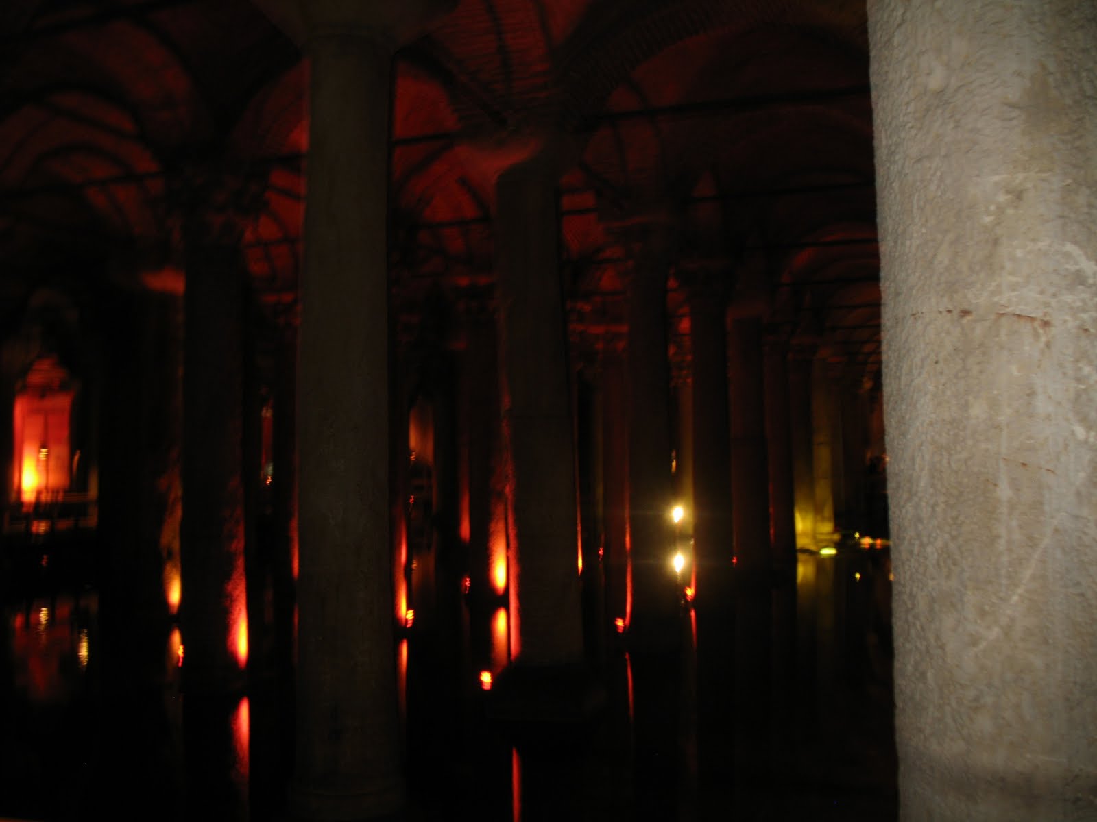
Another pretty ancient place we toured was a Roman cistern. It is underground and was built as a water filtration system. It has had to undergo lots of upkeep, just in the past few decades, there have been major excavations and restoration efforts by the Istanbul Metropolitan Museum. The roof is supported by rows of columns, which, like many other buildings in Turkey, appear to have been nabbed from older buildings due to their mismatching nature. The most intriguing aspect of the columns though are the bases of two columns in the very rear of the cistern. The bases of those two columns are large carved heads of Medusa. One is upright, one is rotated sideways. The positioning of the heads has been hypothesized by some as symbolic and relating to Roman mythology in some way, while others believe it to be just more evidence of random pieces of architecture getting re-used.

This is a picture I took while walking through. The water is pumped from time to time to keep it quite low, probably only a foot deep. Before the 1990's, tourists rode through on row boats. Now there are walkways that wind through.


Something I don't have pictures of but was definitely a notable spot: the Grand Bazaar. Pretty much anything you could imagine buying can be bought here. And for very competitive prices. I got fairly good at bargaining and got some things for more than 50% off! It's the type of place though that's so crowded and sprawling and has such a sense of "you have to buy stuff here!" that I found that I had to be really focused and strategic while there because it would be very easy to spend all your money at the first group of stalls.

So that's the abridged tour of Istanbul (not Constantinople)! I would definitely recommend checking out some of these places online for better pictures and more info. They're all really really cool!

Unless I get a slew of really amazing pictures from others on the trip, this is the end of the Turkey portion of my geologic adventures, 2010.

Tesekkur ederim (thank you [for reading]).

Salaam alaikum,
Sarah
Sunday, August 22, 2010

Sixteen Tons (Cayirhan pt. 2)

Merhaba!

This is part two (sort of) of the previous post:

While we did our economic geology focus in Sivrihisar, investigating the economic viability of a particular type of granite, we could have just as easily written about the economic potential of rocks surrounding the town of Cayirhan. There are two significantly large coal seams just outside the town. We were lucky enough to actually visit the mine there, not only to see the facilities, but also to ride the cart down into the mine! The part of the mine we visited is not currently being mined, but all the equipment was down there, and the miners who escorted us turned on the giant rock-crushing wheel so we could see it in action! According to a paper presented at the 17th International Mining Congress (2001), the Cayirhan coal mine produces 4 million tons of coal annually.

To go on our tour, we had to dress the part: mining company t-shirt, heavy jumpsuits, plastic shin guards, steel-toed boots, hard hats with headlamps, and our toolbelt with our carbon monoxide converter strapped to it. Here is a picture of most of the girls in our gear:


Before going down into the mine, we were given a safety presentation where we were taught how to use the carbon monoxide converter. It's pretty scary, I'm not sure if the equipment is any more user-friendly in the US than in Turkey, but these were pretty nasty little machines. They are little boxes secured to your face by a band around the back of your head, and you bite down on the mouthpiece, making sure to wrap your lips around it to create a secure seal to keep the bad air out. However, it is not an oxygen tank; the way the machine works is that it converts the carbon monoxide to oxygen at the place where you are biting down. The chemical conversion heats up the mouthpiece, and can actually cause third degree burns on your lips. I think in that moment all of us took a minute to reflect on how lucky we were to not have to take that risk every day.

This picture was taken outside the coal mine after we emerged. I think I was trying to ask our Turkish guide a question in this picture (?). The ride in the carts was a looooong way in and out; I think we went about 700 meters under the surface. It felt like a slow version of the "Escape from Pompeii" Busch Gardens ride. It was dark and warm, but we did not emerge by splashing down a chute of water! I'm very glad that we didn't though, because the water we did see running alongside the track the carts rode on was bright orange. I'd seen pictures of water draining out of coal mines, but to see it in person, close enough to touch, was kind of unnerving.


This is a picture of coal mine drainage in a river in Pennsylvania. The water we saw was just as brightly colored as this example.


Overall, the mine trip was definitely eye-opening. It made me wonder how North American mines operate compared with the Cayirhan mine. I wonder in particular how miner safety/health is handled, and if it is very different. I also wonder if environmental issues are taken more seriously in North America. Based on the pictures I've seen from coal mine drainage in the Appalachians, it doesn't really look like it.

Sadly, no pictures from the final week of mapping, probably because the rocks were so hard to find! Next stop: Istanbul!

Salaam alaikum,
Sarah


PS - On the drive from Cayirhan, we stopped at a truck stop with a really nice park/playground. We found a pretty serious swing and had to stop and play on it! Kyle, Morgan, Kate, and I were pushing this side: