Friday, May 13, 2011

Trip West!

Hello all blog followers!

Monday morning at 6 AM I, along with 12 other UT geology students of varying age and grade level, are embarking on a 2-week road trip out west. We will be hitting the big national parks, monuments, and forests on the way: Badlands, Black Hills, Mt. Rushmore, Crazy Horse National Memorial, Tetons, Devil's Tower, Yellowstone, Bighorn Mtns, Glacier, Craters of the Moon, and the Green River Fossil site. And plenty of roadside geology in between! Below is a screen shot of Google maps showing our basic route.


I'll be off the grid while on the road, but I will take pictures and journal so there will be some nice blog posts when I get back!

Happy Trails!
Sarah

Tuesday, December 14, 2010

Meteor Crater adventures

Hola (I was kind of close to Mexico)!

So going back to some geology: in October I had the opportunity to attend the Meteor Crater Field Training and Research Program led by Lunar and Planetary Institute scientist Dr. David Kring. It was a program aimed at planetary geology graduate students. Our group of 24 consisted of students from lots of different universities, and different countries. Two guys hailed from Germany, two students from Austria, one from England, and one from Canada. Of the 18 students from the US, the universities represented were pretty prestigious: MIT, Harvard, Washington U. in St. Louis, University of Arizona, Arizona State, Purdue, Case Western, University of Texas - Austin, University of Colorado - Boulder, and, of course, University of Tennessee! There were two of us from UT, and I felt like that made our department and university look really good to be rubbing shoulders with the Ivy leaguers :) Most of the students (ok, all but me and Matt) were studying some aspect of impact crater formation, either on Earth or other bodies. I was mainly there to skip school (with a good excuse), find a real meteorite, and to get the behind-the-scenes tour of the crater with an expert. I definitely learned a lot about impact cratering - like how much I still don't know! I also learned about how COLD and WINDY Arizona can be in October!!

For starters, here's a picture of me on the crater rim:


Something that I had known before going and had even taught in Geology 104 lab (introduction to the planets) was that a defining feature of a crater is its uplifted rim. However, I hadn't given the word "uplifted" much thought until going there. Northern Arizona is pretty flat, and when you're driving up to the crater, it's definitely noticeably higher than the surrounding area!

The crater is actually "small" by impact crater standards; it's less than a mile across. It's also really young geologically - only about 50,000 years old!! For comparison, the Chesapeake Bay impact structure is 35 million years old and much much larger. Meteor Crater, however, is much better preserved than pretty much any other crater on Earth, making it ideal for study. It was first "discovered" in the late 19th century and was purchased by a fellow named Barringer. Barringer was into mineral exploration/resources and was primarily a businessman, having only an undergraduate degree in geology. He was essentially the first person to call the site a meteorite crater (others, including the head of the US Geologic Survey at the time, thought it was a volcanic feature) so he suspected that the meteorite that produced it may lie at least in pieces in the crater walls or under the crater floor. Basically, he thought he was going to make tons of money from unearthing an enormous iron meteorite. The crater became his obsession for basically the rest of his life. He made amazingly detailed and astute observations. In fact, many of his hypotheses still hold up even now with all kinds of new ways to collect information from the site. Just goes to show that you can learn a lot just by hanging out somewhere and walking around!

There were, however, some key aspects of crater formation that he didn't grasp. He thought the entire meteorite would be buried, intact, underneath the crater floor. He also thought the meteorite would be roughly the size of the hole. Wrong. Meteors that form craters are only a fraction of the size of the craters they form. The crater is formed from pressure and shock waves resulting from the fast-moving meteor crashing into the surface. Usually, the meteorite is either vaporized (if it's small) or broken into many tiny pieces and scattered. So while lots of meteorite fragments have been recovered from the site over the past 100 or so years, no enormous iron blob has been unearthed! But other than that, he pretty much got the story right. Yay for amateur scientists being awesome! Also, the Barringer family still owns the crater. It's actually not a national park/site, which is pretty amazing.

Some things about Meteor Crater that make it unique:
1) It's roughly square-shaped with rounded corners. Most craters on any planet are circular. This is due to the pre-existing perpendicular joints in the rock. When the impact occured, those weaknesses already existed in the rock, so the walls formed along relatively straight lines.
2) After impact, a lake formed in it. This is thought to be not uncommon in very ancient (4.5 - 3.75 billion year old) Martian craters.
3) A few areas around the rim are higher due to huge chunks of rock being shoved into the crater walls as they were forming. Weird.
4) Astronauts train there!
5) All the rubble/old mining equipment has been left the way it was after mining efforts ceased, so it's completely historically accurate.
6) It was a filming location for the 1980's movie, Starman. We watched it one night... I would not necessarily recommend.

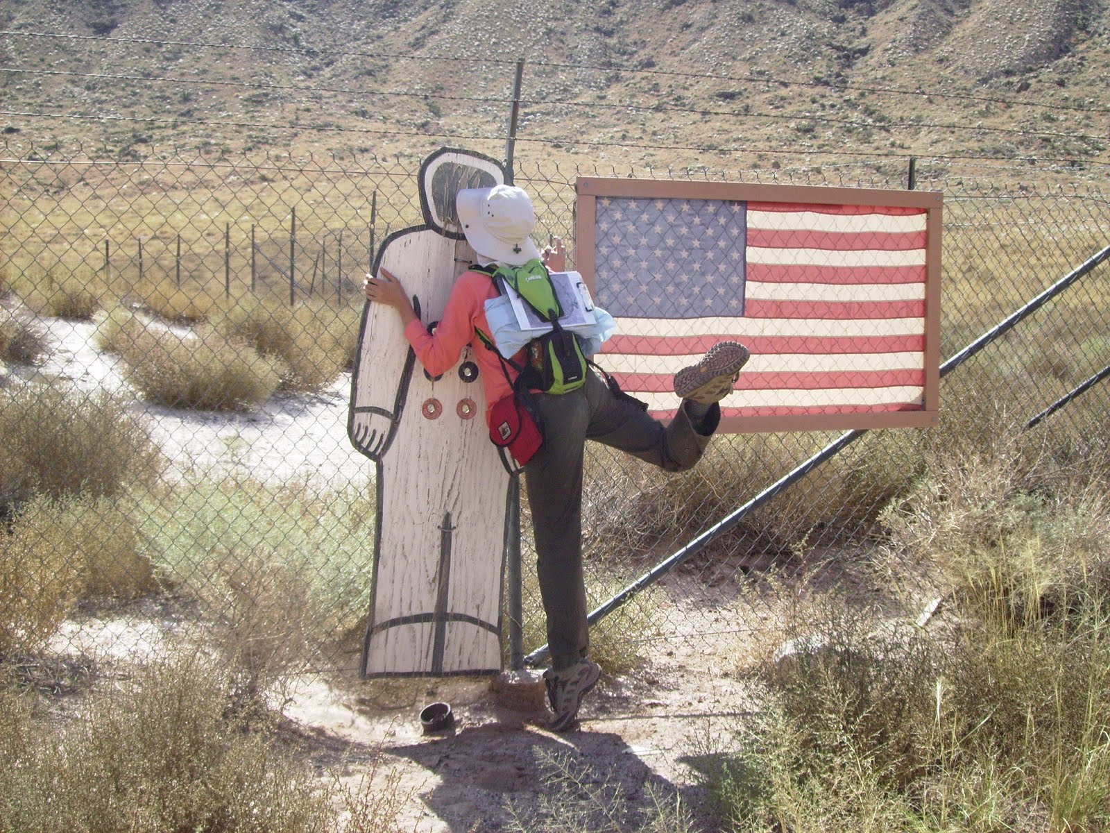
Apollo-era astronauts did a lot of training at Meteor Crater. On the crater floor (off-limits to tourists, but we got to go down), there is an American flag set up with a wooden astronaut cut-out next to it. Here's a picture of me and the astronaut:


Apparently rovers are trained there, too! Here's a Canadian Space Agency group testing a rover:


We spent the first two days basically hiking around and through the crater, which was pretty cool. Dr. Kring told us that taking samples from the crater was prohibited for tourists. Scientists were permitted to take samples that had already fallen to the crater floor to use for research, but each piece must be documented and registered. Any meteorite chunks that are found have to be left alone if they're still in the crater wall. They can be collected by meteorite scientists after they've weathered out, but Dr. Kring said that usually they would get lost in the material that had been rained down the slopes during the rainy season. He did show us a nice sample still stuck in the wall. We weren't even allowed to sit less than 5 feet away from it! Here he is pointing it out to us (it's the dark blob in the pinkish rock to his left):


Even though we weren't allowed to collect our own meteorites, we still ended up with samples anyway! A professor from Arizona State drove up and talked to us about meteorites and gave us goody bags with teeny meteorites from Meteor Crater in them!

We camped in tents at the Meteor Crater RV Park. Our fellow RV park residents were pretty colorful characters. We were the only group in tents, with the exception of a group of three hunters. They were pretty old and woke up at 4 AM every morning. Good campfire entertainment. Here's a picture of our tents lit up at night:


Our main project while there was to contribute to a research project Dr. Kring was heading up. We did all the data collection for the project and took lots of good pictures for the paper that will result. Admittedly, I didn't understand a ton of what we "discovered" but I did contribute by making very detailed rock descriptions!

At the end of the day, I learned a lot. I networked with my planetary peers, which is never a bad thing. I also learned though, that if you're going to Arizona in October, bring LOTS OF WARM CLOTHES and an alpine-grade sleeping bag. Consider yourselves warned! Sadly, we missed the Grand Canyon (not enough time!) but the trip definitely whet my appetite to explore the southwest!

Vaya con Dios!
Sarah

Monday, December 13, 2010

Istanbul, not Constantinople

Merhaba!

Sorry to leave you all in suspense! I did leave Turkey and have been back in the US since my trip over the summer :) This will be my last post about Turkey (unless the photo sizes are too large, then there may be multiple parts to this message!).

This post has nothing to do with geology, but shows that under the auspices of doing geology, one can do some awesome sight-seeing!

Our group, after field camp, informally spent a few days sight-seeing in Istanbul. What an amazing city. I definitely don't think I can do the city justice here, but hoepfully these pictures and totally incomplete descriptions will lead you all to Wikipedia some of these amazing historic sites we visited.

First off, if you haven't heard the song, "Istanbul, not Constantinople" you need to.
Link: http://www.youtube.com/watch?v=vankaSlfSr0 (original Four Lads version with nice pictures)
http://www.youtube.com/watch?v=JeQ-wjDH4F4 (more jazzed up version, and with accordian!!)
Pick one and watch before proceeding. Unless you live in Turkey, in which case your government has blocked YouTube. Not joking!!!

Ok, so now that you've educated yourself on the abridged history of this fascinating city (it was Constantinople, now it's Istanbul) let's look at some good examples to show these two identities still visible in this city!

Istanbul is geographically split by the Bosphorus Strait, which flows into the Sea of Marmara, which then flows into the Aegean. So on the east side of the Bosphorus, the city is considered part of Asia. The west side of the Bosphorus is European. Taking afternoon cruises up/down/across the Bosphorus is a popular tourist activity and is definitely on my list of things to do NEXT TIME! We were out of money so we opted for swimming in the Bosphorus instead :)

Here is a view of the Bosphorus from the roof of our hostel:
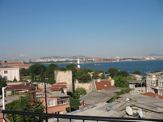


We spent basically all of our time on the western shore in a neighborhood called Sultanahmet, which is where the major historic sites are. The two most impressive and well-known structures are the Blue Mosque and the Aya Sofya (Turkish spelling) aka the Hagia Sophia (Greek spelling). The Blue Mosque is an active mosque that tourists can walk through for free. It got its name for all the blue decor inside. It was required that visitors cover their arms, legs, and shoulders - even the men had to wear skirts provided at the door if they were wearing shorts. Surprisingly, women were not asked to cover their heads, but seeing as how I had brought my scarf that day anyway, I thought I'd take the more "modest" route. The Blue Mosque has a slightly scandalous history: it was originally designed to have 6 minarets. This doesn't seem like a big deal, but the only other mosque in the world (at that time at least) with 6 minarets was at Mecca. Religious leaders advised that completing construction with this design would effectively be giving Mecca the middle finger (not something most devout Muslims would want to do). The Sultan was a rebel though and decided to go with it anyway! It was completed in the early 1600's, making it one of the youngest historic sites in the city.

It was hard to capture the Blue Mosque in pictures, especially the inside because it's so incredibly massive, but here is my best effort (may be modified later if Andrea has any that are better):


I think one thing that really struck me about the art in religious buildings in Turkey vs. in the US is that even in the most impressive Christian churches in the US, the art is restricted to stained glass windows, some statues, and possibly some stuff up at the altar. In Turkey though, no square inch of usable wall space is spared for decoration it seems!

The Aya Sofya has a longer and more complex history. "Aya Sofya" means "divine wisdom" in Turkish which I think is an awesome title for a church! Yes, the Aya Sofya was actually built as a Christian church during the time when Istanbul was Constantinople, during the Byzantine era. Prior to going to Turkey I knew nothing about the Byzantines and sadly, I still know basically nothing! But perhaps a Christmas gift in the form of some sort of light-weight reading on the subject would help! ;) Anyway, according to Wikipedia, Byzas, a Greek king, founded the city in 667 BC. It was later sacked by the Romans and the famous emperor Constantine rebuilt the city in 330 AD, making it the capital of the Eastern Roman Empire. He ordered a large church built in his new city, the Aya Sofya. The Aya Sofya was completed in the mid-300's and was the largest cathedral in the world until 1520. The building seen today is version #3 (completed in the 500's) as the first two were destroyed. After the Ottomans seized Constantinople in 1453, the Aya Sofya was converted into a mosque. 4 minarets were constructed and many mosaics and paintings were destroyed at least in part. Islamic art does not allow faces of living things to be portrayed (only God can create living things) so many of the mosaics in the Aya Sofya were damaged during that time to make them "acceptable." Additions were made to the inside of the building, including large black medallions with gold Arabic script. In the 1930's, the Turkish government took control of the building and secularized it, making it into the museum it is today, however, no restorative work has been done. Interested readers should check out this Wikipedia article: http://en.wikipedia.org/wiki/Aya_Sofya

This building was really cool, inside, and outside. I think this picture is a good representation of the clash of Islam and Christianity. The painting on the dome is Mary holding Jesus, with two basically destroyed angels (one on each side). The black and gold medallions flanking the painting were added by the Ottomans.


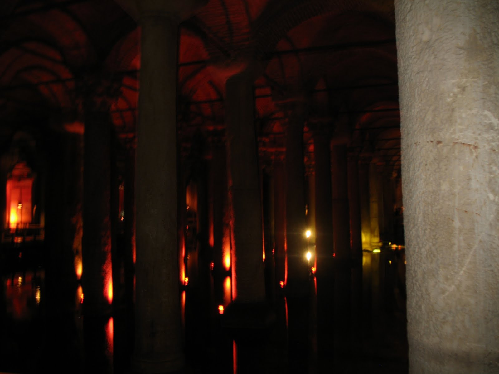
Another pretty ancient place we toured was a Roman cistern. It is underground and was built as a water filtration system. It has had to undergo lots of upkeep, just in the past few decades, there have been major excavations and restoration efforts by the Istanbul Metropolitan Museum. The roof is supported by rows of columns, which, like many other buildings in Turkey, appear to have been nabbed from older buildings due to their mismatching nature. The most intriguing aspect of the columns though are the bases of two columns in the very rear of the cistern. The bases of those two columns are large carved heads of Medusa. One is upright, one is rotated sideways. The positioning of the heads has been hypothesized by some as symbolic and relating to Roman mythology in some way, while others believe it to be just more evidence of random pieces of architecture getting re-used.

This is a picture I took while walking through. The water is pumped from time to time to keep it quite low, probably only a foot deep. Before the 1990's, tourists rode through on row boats. Now there are walkways that wind through.


Something I don't have pictures of but was definitely a notable spot: the Grand Bazaar. Pretty much anything you could imagine buying can be bought here. And for very competitive prices. I got fairly good at bargaining and got some things for more than 50% off! It's the type of place though that's so crowded and sprawling and has such a sense of "you have to buy stuff here!" that I found that I had to be really focused and strategic while there because it would be very easy to spend all your money at the first group of stalls.

So that's the abridged tour of Istanbul (not Constantinople)! I would definitely recommend checking out some of these places online for better pictures and more info. They're all really really cool!

Unless I get a slew of really amazing pictures from others on the trip, this is the end of the Turkey portion of my geologic adventures, 2010.

Tesekkur ederim (thank you [for reading]).

Salaam alaikum,
Sarah

Sunday, August 22, 2010

Sixteen Tons (Cayirhan pt. 2)

Merhaba!

This is part two (sort of) of the previous post:

While we did our economic geology focus in Sivrihisar, investigating the economic viability of a particular type of granite, we could have just as easily written about the economic potential of rocks surrounding the town of Cayirhan. There are two significantly large coal seams just outside the town. We were lucky enough to actually visit the mine there, not only to see the facilities, but also to ride the cart down into the mine! The part of the mine we visited is not currently being mined, but all the equipment was down there, and the miners who escorted us turned on the giant rock-crushing wheel so we could see it in action! According to a paper presented at the 17th International Mining Congress (2001), the Cayirhan coal mine produces 4 million tons of coal annually.

To go on our tour, we had to dress the part: mining company t-shirt, heavy jumpsuits, plastic shin guards, steel-toed boots, hard hats with headlamps, and our toolbelt with our carbon monoxide converter strapped to it. Here is a picture of most of the girls in our gear:


Before going down into the mine, we were given a safety presentation where we were taught how to use the carbon monoxide converter. It's pretty scary, I'm not sure if the equipment is any more user-friendly in the US than in Turkey, but these were pretty nasty little machines. They are little boxes secured to your face by a band around the back of your head, and you bite down on the mouthpiece, making sure to wrap your lips around it to create a secure seal to keep the bad air out. However, it is not an oxygen tank; the way the machine works is that it converts the carbon monoxide to oxygen at the place where you are biting down. The chemical conversion heats up the mouthpiece, and can actually cause third degree burns on your lips. I think in that moment all of us took a minute to reflect on how lucky we were to not have to take that risk every day.

This picture was taken outside the coal mine after we emerged. I think I was trying to ask our Turkish guide a question in this picture (?). The ride in the carts was a looooong way in and out; I think we went about 700 meters under the surface. It felt like a slow version of the "Escape from Pompeii" Busch Gardens ride. It was dark and warm, but we did not emerge by splashing down a chute of water! I'm very glad that we didn't though, because the water we did see running alongside the track the carts rode on was bright orange. I'd seen pictures of water draining out of coal mines, but to see it in person, close enough to touch, was kind of unnerving.


This is a picture of coal mine drainage in a river in Pennsylvania. The water we saw was just as brightly colored as this example.


Overall, the mine trip was definitely eye-opening. It made me wonder how North American mines operate compared with the Cayirhan mine. I wonder in particular how miner safety/health is handled, and if it is very different. I also wonder if environmental issues are taken more seriously in North America. Based on the pictures I've seen from coal mine drainage in the Appalachians, it doesn't really look like it.

Sadly, no pictures from the final week of mapping, probably because the rocks were so hard to find! Next stop: Istanbul!

Salaam alaikum,
Sarah


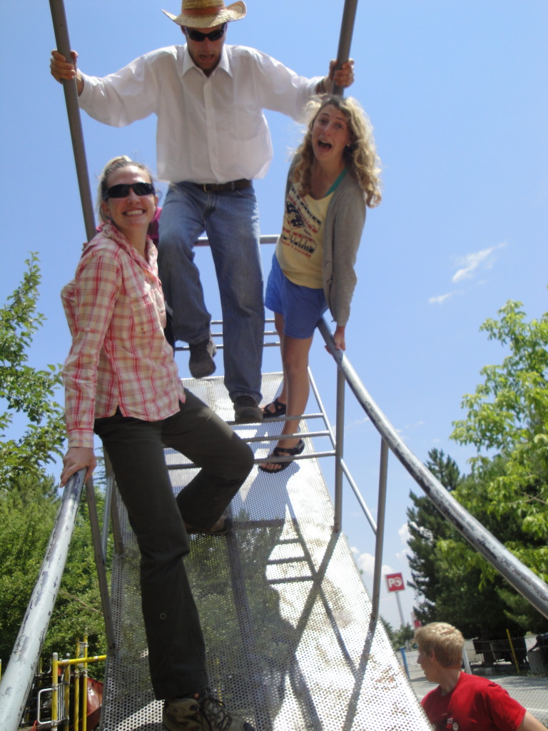
PS - On the drive from Cayirhan, we stopped at a truck stop with a really nice park/playground. We found a pretty serious swing and had to stop and play on it! Kyle, Morgan, Kate, and I were pushing this side:


Desert Rose

Merhaba!


So this post is very obviously not being written from Turkey, so maybe is lacking in authenticity, but I figured that I should probably finish the narration of my geologic adventures there, no matter how belated! And I recently read an online article that encouraged graduate students to practice writing - in any form - as often as possible. One of the suggestions was keeping a blog, so that provided additional motivation to finish this story!

Our third week of field camp was spent in Sivrihisar. The following week was spent in Cayirhan, which was the most arid area we worked in. As you can see behind me in the picture below, the rocks here were really beautiful! One formation in particular, aptly named the "Cayirhan Formation," was especially pretty with its pink, cream, and aqua stripes, kind of like Aquafresh toothpaste! Most of the rock formations in this area are cream-white in color, which I thought looked very "clean." Our instructor warned us against sunlight reflecting off the white sand and rocks, warning that some of his colleagues had actually gotten sunburned inside their nostrils from very white sand in the Sahara Desert! Fortunately, that did not happen to anyone on our trip :) You may notice that the layers of rocks are surprisingly horizontal. This is because these rocks were formed in lakes during the Miocene epoch, 11 million years ago. Lakes, especially in the center, are very quiet environments so fine-grained sand and mud form very even, smooth layers as they settle out of the water.


This is what a waterfall looks like without water flowing down it. That is Andrea standing in the middle of the bend. This was just the very bottom of the canyon, it actually extended up much further!


Our "fundamental question" for this mapping area was to look for indicators of faults. There were three major faults within the area we mapped. They stuck out very noticeably from the rest of the landscape and formed very narrow ridges. This is a picture of our whole class sitting on a fault. The fault is the flat surface to our right.


Ok, I want to post more pictures from the Cayirhan week, but they won't all fit in this entry, so check out part 2!

Salaam alaikum,
Sarah

PS - We didn't find any desert roses, but we did see a desert praying mantis! He was sand-colored, so he blended right in!

Thursday, July 15, 2010

Turkish weddings

Merhaba!

So this post is out of date for sure, but I was waiting for pictures from this event. I still only have one low-quality picture, but if I find any more, I'll add them later!

A few weeks ago, we were invited to a wedding in town. The bride is a relative of Nejla's. Weddings are a HUGE event here! Going to any average-size town, you're sure to find at least one bridal shop with completely over-the-top dresses; the types of dresses little girls DREAM of wearing: saturated in sequins with layers and layers of puffy organza. There are also wedding shows on TV in the afternoons - similar to TLC's "A wedding story" or other types of shows I guess. On the show, there are several couples who actually are wed on the set of the show. Crazy!

In our town, because it is small, the entire town was invited to the wedding, basically. Festivities went on all day long: during the day there was a processional of sorts, where the bride is driven to her new husband's family's home with all her things. This requires multiple cars, so the cars line up down the road from her family's house to his family's house, carrying all her clothes, etc., honking their horns super loudly. Even today, in rural areas, often times men stay in their parents' homes and the wife moves in with his whole family. I think there was probably a religious ceremony at the mosque (maybe?) but we were invited to the public ceremony at the town hall. The bride's dress was CRAZY - she looked just like Nia Vardalos in "My Big Fat Greek Wedding." The groom looked equally crazy - his tuxedo jacket, on the part where the satin stripes usually are, he had a row of rhinestones. I believe there may have also been something pink involved. I've noticed that in the small towns we've been to, typically the color pink or purple is used to make things look fancier or prettier. So even some formal menswear can have touches of pink or purple - but not like a tie or dress shirt - that would be way too subtle! Definitely have to have some pink stripes on your tux jacket!

The first part of the wedding was the ring ceremony and the giving of gifts. The ring ceremony, having watched it on TV multiple times now and witnessed it, still confuses me. Each ring is tied to one end of a red ribbon, the rings are put on the bride and groom by the person marrying them, they do not put them on each other, and then the ribbon is cut. It seems like if they would do anything would the ribbon, it would be tied? After the ring ceremony, the couple stands in the front of the room and all the men in the room go through a line, giving the couple money. The bills are pinned onto the groom's tuxedo, so afterwards the man was barely visible underneath all the bills! He looked like a strange Christmas tree. Here's a shot of the bride and groom and the money-pinning line:


Shortly after the ceremony was dancing. There was a men's group dance where all the men were in a circle (again, similar to My Big Fat Greek Wedding!) with arms around each other's shoulders, moving back and forth around the circle. There was another dance done in two lines facing each other where, from what we all could tell, you basically just have a "partner" of the same sex standing across from you, and you do some sort of foot shuffle and hold your arms up, snapping your fingers to the music. Some of the men had very fancy footwork going on! Women were allowed to take part in this dance, but only little girls actually did. Our bus driver (a HILARIOUS DANCER) dragged all of us onto the dance floor, as did Nuri and Nejla's husband. There were several older women in the front of the room, and when we left the dance floor, the women were trying to get us back up there to keep dancing! We figured all the locals were probably getting a good laugh.

Outside the social hall, there was basically a small street fair. There were food vendors selling Turkish pizza and other snacks as well as children's toys. The food provided at the ceremony was several plates of assorted cookies for each table and boxes of sour cherry (visne) juice! We got a good laugh out of that. Here's a picture of a few of us at our table with our juice boxes:


It was a really fun experience. Everyone there seemed to be really enjoying themselves. It was also cool to recognize a good number of people in the room from the market.

Uh oh! Bus is here, time to go!

Salaam alaikum,
Sarah

Friday, July 9, 2010

Summiting Mt. Doom


Merhaba!
In an effort to not be TOO far behind on my blogging, here's a little bit about my week in Sivrihisar (not last week, but week before, that's how behind I am!). We traveled 4 hours by bus down windy mountain roads to this location to look at metamorphic and igneous rocks. We saw two granites, and mountains made out of marble. Because the marble was weathered though, it wasn't shiny or smooth or counter-top quality in appearance - it was lack-luster in a literal sense. It was easy to distinguish though based on the lack of vegetation growing on it. Because there was so little vegetation, it was easy to get great views from the ridges on which we were mapping, whereas at our local mapping spot you can't really see much through the trees. This is good for locating outcrops and finding yourself on a map, but it means lot of extra sun protection needed! One of the guys in our group is from the southwest and he made the comment that in our 4 hour drive it felt as if we'd gone from Italy to New Mexico.


The one area in the mapping area that did appear to be lush with vegetation (relatively) was the highest peak in the area. It looked like Mt. Olympus from the lower slopes because there always seemed to be a crown of fluffy white clouds hovering above it. Here's a shot from below:


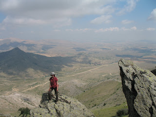
My mapping partner, Marcus, and I decided on day 1 that we would get our map finished in time to spend an hour hiking to the top to check it out, which we did manage to do. Being not so poetically-minded, he named it "Mt. Doom" as a reference to Lord of the Rings. It was pretty strenuous, and like any mountainous area, it looked closer than it was for a long time, and when we got to the top it was hard to tell if we were actually at the highest point, but we're pretty sure we made it! Here I am at a point close to the top, protecting myself from every possible ray of sunlight even from other suns in other galaxies:


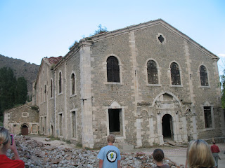
While in Sivrihisar, we did some cultural sight-seeing after dinner one night. Sivrihisar used to be an dominantly Armenian community several hundred years ago, and we visited an old Armenian church that it being restored. This is the church, pretty standard appearance:


These are some gargoyles that are on the side of the building:


Although the community was dominantly Armenian (therefore, Christian) until relatively recently, there have also been Muslim people living there for a long time - we went inside a 700-year old mosque! It was all wooden and had a very ancient feel to it. The entire floor was covered in very colorful rugs for prayer. There is a balcony of sorts that is curtained off where the women pray so that the men are not distracted by the women while in prayer. Something I thought was pretty neat architecturally were the columns supporting the ceiling indoors. The columns were wooden, but the tops of the columns were marble and had a variety of styles: Doric, Ionic, Corinthian. We were told by our guide that when the mosque was built, these pieces had been taken from ruins of ancient Greek temples and buildings in the area and used to top the wooden columns. Just shows how many different groups of people have inhabited this area throughout history!

On the drive back from Sivrihisar we made a seemingly random roadside stop to check out some blueschist rocks. Blueschist is a VERY high pressure metamorphic rock and is VERY beautiful. Blueschist forms in subduction zones where one tectonic plate is dragged underneath another and the underlying plate experiences extremely high pressures. Studies done in this area show that these rocks formed at a depth of about 100 kilometers below the Earth's surface! The craziest part is that they've made it all the way back up to the surface where they're just sitting in this tranquil, wooded glen. Blueschist, because it forms deep in the earth, has a tendency to actually change to a different rock when exposed to surface conditions, so it's not easy to find in an unadulterated state.

That's pretty much all the excitement from week 3! Week 4 post coming soon!

Salaam alaikum,
Sarah